Bay Area Backcountry: San Rafael
|
|
| Up |
|
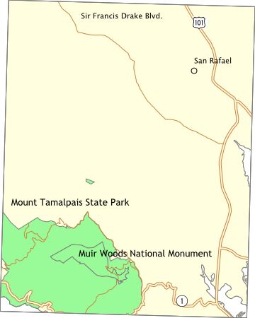
OverviewFrom the top of Mt. Tamalpais you can see the Farallon Islands, the Sierra Nevada, and the Cascades. The park is big by itself, but the trails also extend into the surrounding countryside. There is a walk-in campground, Pantoll, with potable water and restrooms. No reservations accepted. Lee Shansky Memorial Trail Camp, just a few miles south of Pantoll, has environmental sites - no water or toilets. Reservations are recommended. Alice Eastwood Group Campground has all of the normal features and can handle 100 people. Reservations required. There are also some cabins and a few environmental campsites in Steep Ravine, overlooking the Pacific Ocean. One of the cabins is handicap accessible. Water and toilets are available. Reservations required. You can walk to the Muir Woods National Monument (the two parks share a border). Trails also extend into the undeveloped areas around the parks. |
Activities
Backpacking
Getting ThereFrom Highway 101 near Mill Valley, take Highway 1 west to the Panoramic Highway then turn northward. The directions for Steep Ravine are completely different - you'll get them when you make a reservation. USGS 7.5' Topo Maps
Point Bonita
Further Information
Mount Tamalpais State Park
Links |