Bay Area Backcountry: Bolinas
|
|
| Up |
|
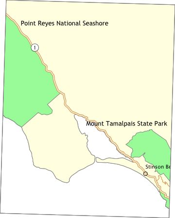
OverviewFrom the top of Mt. Tamalpais you can see the Farallon Islands, the Sierra Nevada, and the Cascades. The park is big by itself, but the trails also extend into the surrounding countryside. There is a walk-in campground, Pantoll, with potable water and restrooms. No reservations accepted. Lee Shansky Memorial Trail Camp, just a few miles south of Pantoll, has environmental sites - no water or toilets. Reservations are recommended. Alice Eastwood Group Campground has all of the normal features and can handle 100 people. Reservations required. There are also some cabins and a few environmental campsites in Steep Ravine, overlooking the Pacific Ocean. One of the cabins is handicap accessible. Water and toilets are available. Reservations required. You can walk to the Muir Woods National Monument (the two parks share a border). Trails also extend into the undeveloped areas around the parks. |
Activities
Backpacking
Getting ThereFrom Highway 101 near Mill Valley, take Highway 1 west to the Panoramic Highway then turn northward. The directions for Steep Ravine are completely different - you'll get them when you make a reservation. USGS 7.5' Topo Maps
Point Bonita
Further Information
Mount Tamalpais State Park
Links |
OverviewPt. Reyes has over 60,000 acres of mostly untouched land, extending from the shore over some low hills. There are four campgrounds in the park - camping is allowed only in the campgrounds. Campers are limited to a total of four nights. Check in at the visitor center before departure - trails are often impassable and water at the campgrounds can be tainted. All campgrounds have water, fire grills (you know, a metal box on top of a three foot high pole), toilets, food lockers, and a hitching rail for you horse. Campground reservations are required, and can be made up to three months in advance. Get reservations early - this is a popular place. Just north of Pt. Reyes is a large private campground - Olema Ranch Campground - with water, toilets, and showers. Reservations accepted at (415) 663-8001. $16 and up per night. |
Activities
Backpacking
Getting TherePoint Reyes is located off highway 1, 40 or 50 miles north of the Golden Gate Bridge. The visitor center is near the town of Olema. USGS 7.5' Topo Maps
Bolinas
Further Information
Point Reyes National Seashore
Links
Mapquest.com Map
|